FARO GeoSLAM: faster and better surveying
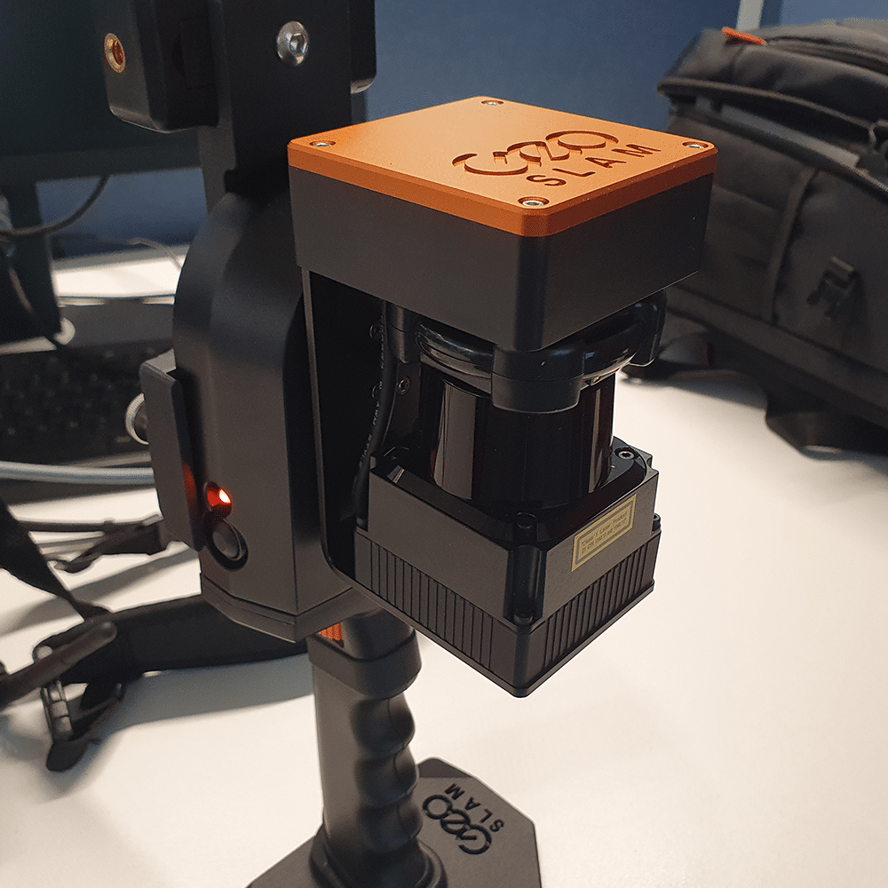
The emergence of 3D scanning technologies has revolutionized several industries, including retail. One of the most striking advances comes from the Faro Geoslam scanner.
This scanner is a valuable addition to NewArmstrong’s portfolio for 3D measurement due to its impressive functionalities and broad application possibilities.
Operational benefits from the new way of measuring
Precision and Speed
The precision of the Faro Geoslam scanner is similar to the Faro Focus, which NewArmstrong has used for years for 3d surveying. However, the method of scanning is significantly different: where the Focus scans from a stationary position, the GeoSlam uses walk-by scanning.
There is another difference: the Faro Focus can measure accurately at much greater distances (50-100 meters) than the Faro Geoslam . Thus, the Geoslam is better suited for smaller spaces.
With its advanced LiDAR (Light Detection and Ranging) technology, the device can take detailed 3D measurements of both indoor and outdoor environments in minutes and process them directly into a Point Cloud (SLAM: Simultanious Locatization And Mapping). This means significant time savings compared to scanning and linking afterwards.
Mobility and Flexibility with measuring
The mobility of the Faro Geoslam scanner is another asset. Its portability allows our Scan operators to navigate effortlessly through complex spaces, such as tight corridors, stairwells and other inaccessible locations.
This flexibility makes it a valuable tool in various sectors, such as retail, supermarket properties, offices, hospitality(hotel rooms), sports, swimming pools, spas, family entertainment centers, automotive.
Intuitive User Interface
Another factor contributing to the popularity of the Faro Geoslam scanner is its user-friendly interface.
The software is designed with the end user in mind, making the process of data collection, processing and analysis simple. This minimizes the learning curve for new users and increases the efficiency of the entire scanning process.
Applications
The application possibilities of the Faro Geoslam scanner are diverse and extensive. In the construction industry, for example, it is used for creating accurate as-built models, checking structures and facilitating renovation projects.
SLAM (Simultaneous Localization and Mapping) with the Geoslam
SLAM (Simultaneous Localization and Mapping) plays a crucial role in the functionality of the Faro Geoslam scanner. SLAM is an advanced technique that determines a device’s location in real time while simultaneously creating a map of its surroundings. This is especially relevant for devices such as the Faro Geoslam, which capture accurate 3D information in real time.
This scanner uses SLAM algorithms to determine its position as it moves through an environment. In doing so, it combines information from various sensors, such as LiDAR, cameras and IMUs (Inertial Measurement Units).
By continuously scanning its surroundings while determining its own location, the Faro Geoslam can generate an accurate 3D map as it moves through a room.
The strength of SLAM in the context of the Faro Geoslam scanner comes from its ability to provide autonomy to the scanning process. This technology enables the device to locate itself without external reference points, which is essential in environments where traditional measurement methods are inadequate or where placing markers is impractical.
By integrating SLAM, the Faro Geoslam scanner offers not only fast and accurate 3D measurement, but also the ability to do so in environments that are challenging for other measurement methods.
Continued development and refinement of SLAM algorithms are expected to continue to improve the functionality of the Faro Geoslam scanner, making it even more accurate, faster and more reliable for a wide range of applications. This strengthens the position of the Faro Geoslam scanner as an indispensable tool for high-quality 3D measurements in various projects.
Future Prospect
Technological progress does not stand still, and the Faro Geoslam scanner is constantly evolving to meet the growing demands of various industries. Improvements in resolution, range and data processing will continue to enhance the scanner’s functionality and accuracy.
The adoption of this technology enables NewArmstrong to operate faster, achieve cost savings at complex sites and provide higher quality with fewer operational disruptions.
The Faro Geoslam scanner has proven itself to be an indispensable tool for professionals requiring high-quality 3D measurements in NewArmstrong projects.
Examples include surveying 80,000 m2 of commercial property for a NEN 2580 report in 5 weeks. But also surveying more than 20 stores for a rollout in two weeks is only feasible with the Faro Geoslam.


